At 47 square miles, San Francisco might be one of the smallest major cities in the United States (New York City, by comparison, is 302 square miles). But it has something many other major cities don’t: geography. It’s big on hills and natural wonders. Mount Davidson, the highest natural point in the San Francisco city limits, is higher than any spot in five of the country’s states. That often translates into dramatic scenic views and trails with their fair share of ups and downs; it’s no surprise that the city has great hikes where both the walk and the view will get your heart pumping.
Batteries to Bluffs
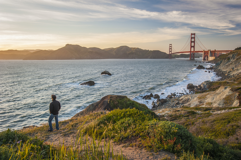
This trail on the Presidio’s rugged western coastline weaves among the bluffs and beaches and the long-silent gun batteries of the former military base. It drops down from Lincoln Boulevard, a portion of the California Coastal Trail, via a series of stairs and paths among wildflowers, dune grasses and scrub brush. Explore Battery Crosby, a one-time gun emplacement that these days is the military equivalent of a ghost town. The landscape and views of the coast make it easy to forget you’re in a big city—though you can’t get lost because some portion of the Golden Gate Bridge is nearly always visible. Along the way, watch for signs for a side trail down to isolated Marshall’s Beach. The route eventually climbs back up and ends at Lincoln Boulevard. If you continue a quarter mile more on the coast trail, it leads to Battery West, sprawling Battery Godfrey and the Golden Gate Overlook, one of the best vantage points for Instagram shots of the majestic bridge.
The southern trailhead is on Lincoln Boulevard, just north of Baker Beach, across the road from the trailhead to the Immigrant Point Overlook. presidio.gov
Twin Peaks
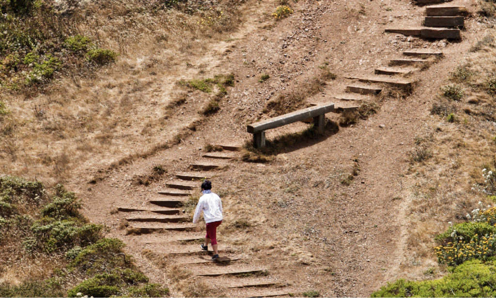
The trails on Twin Peaks are not about escaping the urban landscape so much as offering the best view of it. From the 922-foot summits of Eureka Peak and Noe Peak, San Francisco is laid out in every direction, with the grand boulevard Market Street pointing to the heart of downtown. Saying this 64-acre city park has trails might be a little charitable: Twin Peaks Boulevard leads up to the peaks and the Christmas Tree observation point (the road was closed at press time) and the only “trails” are stairs up to the peak tops or down to civilization. Twin Peaks sometimes holds back the coastal fog, so there’s a chance the view might be, well, fluffy and white. Dress in layers.
Stairs also climb from Crestline Drive, south of Parkridge Drive, to the park. It’s also possible to walk up Twin Peaks Boulevard from Burnett Avenue, but there’s no sidewalk, just a bike lane. sfrecpark.org
Fort Funston

Fort Funston is a windswept wedge of 200-foot bluffs, rolling dunes and the southern portion of Ocean Beach known as Funston Beach. It all seems serene considering the former military outpost was home to batteries of 16-inch guns and Nike missiles. The California Coastal Trail within Fort Funston meanders south from the Great Highway through the grassy dunes before climbing to the top of the bluffs and the hulking Battery Davis. Past the battery, there’s less protection from the breeze—the wind is so reliable, there’s a platform for launching hang gliders near the park’s south end. The trail works its way back down to the beach.
There’s a parking lot and restrooms off of Skyline Drive, south of John Muir Drive. The northern trailhead is on the Great Highway, near Skyline Boulevard. parksconservancy.org
Land’s End and Coastal Trails
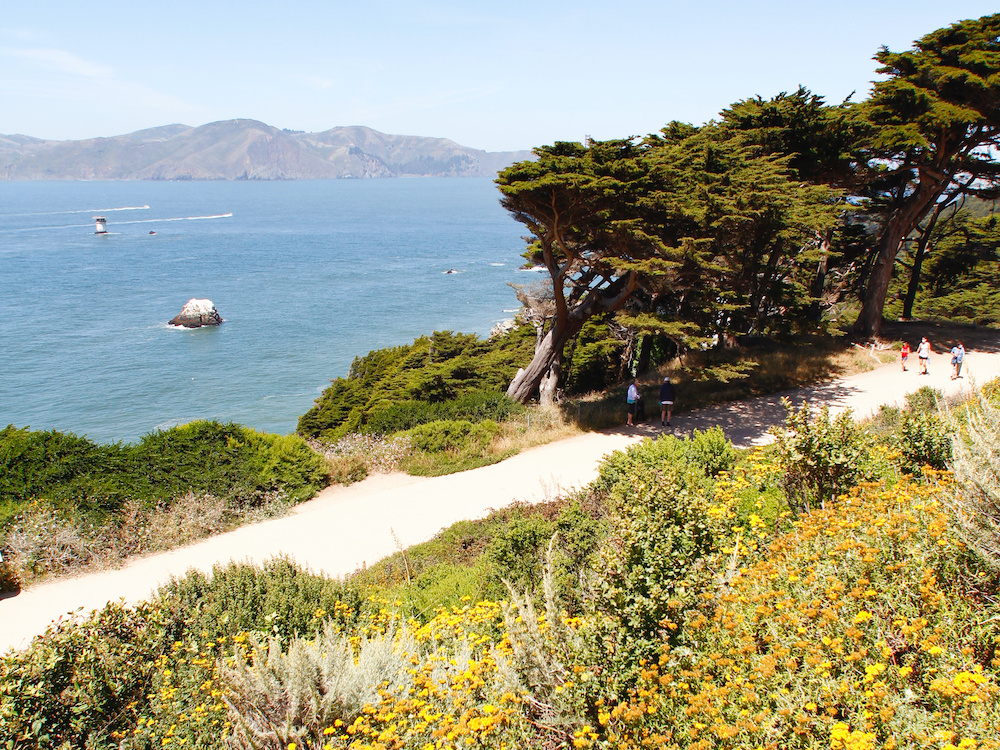
The view from Land’s End is a re-minder that the Golden Gate Bridge is actually inset from the California coast by about 2 miles and that most of that distance is hikeable. The Land’s End Trail, from Land’s End to Eagle Point, is the first leg. The trail winds along the bluffs with postcard-worthy views of the rocky coastline, the Marin Headlands and, of course, the bridge. The route dips into denser woodlands, making it seem like the city is worlds away; it’s actually a 9-iron swing from the third hole at Lincoln Park Golf Course. About midway, a set of stairs and a trail lead down to Mile Rock Beach and the Instagram-worthy Land’s End Labyrinth. After more stairs and paths, the trail hits Eagle Point look-out then ends at Lincoln Highway.
Parking is easiest at the USS San Francisco Memorial lot at the end of El Camino del Mar. Descend the stairs to the Eastern Overlook to access the Coastal Trail. parksconservancy.org
Header photo by Mason Cummings/Parks Conservancy. Photos by Spud Hilton.